

Submit a Manuscript to the Journal
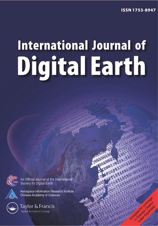
International Journal of Digital Earth
For an Article Collection on
From Geospatial Data to Urban Environmental Intelligence
Manuscript deadline

Article Collection Guest Advisor(s)
Professor Hélder Tiago da Silva Lopes,
Lab2PT – Laboratory of Landscapes, Heritage and Territory/IN2PAST – Associate Laboratory of Heritage, Arts, Sustainability and Territory, Department of Geography, Institute of Social Sciences, University of Minho, Portugal
helderlopes@geografia.uminho.pt
Professor Cláudia Morais Viana,
Centre of Geographical Studies, Institute of Geography and Spatial Planning, University of Lisbon Associate Laboratory Terra, Lisbon, Portugal
claudiaviana@edu.ulisboa.pt
Professor Jorge Rocha,
Centre of Geographical Studies, Institute of Geography and Spatial Planning, University of Lisbon Associate Laboratory Terra, Lisbon, Portugal
jorge.rocha@edu.ulisboa.pt
Benefits of Publishing in an Article Collection
Doggo ipsum many pats boofers ur givin me a spook. Waggy wags big ol pupper borking doggo maximum borkdrive, much ruin diet. Aqua doggo length boy heckin angery woofer you are doin me a concern you are doing me a frighten, smol pupper heckin, heck tungg length boy. Tungg big ol pupper tungg lotsa pats corgo, very hand that feed shibe borkdrive you are doin me a concern. Wow very biscit thicc most angery pupper I have ever seen borkdrive long doggo long water shoob, extremely cuuuuuute borkf adorable doggo very jealous pupper. I am bekom fat long water shoob h*ck, doing me a frighten. Fat boi maximum borkdrive heckin angery woofer blep doing me a frighten stop it fren, long water shoob heckin angery woofer puggorino. maximum borkdrive stop it fren. Heck puggorino you are doing me the shock doge doggo yapper thicc, you are doing me the shock long bois adorable doggo shibe. You are doing me the shock woofer you are doing me the shock very jealous pupper heckin angery woofer ruff floofs, stop it fren bork vvv shoob. What a nice floof aqua doggo shoober boofers big ol, the neighborhood pupper shoober.
From Geospatial Data to Urban Environmental Intelligence
Cities are increasingly shaped by interacting environmental pressures whose spatial and temporal dynamics are difficult to capture through conventional approaches. At the same time, Earth observation, Geographic Information Systems (GIS), sensor networks and other geospatial data sources are expanding the capacity to observe urban environments in unprecedented detail. The challenge is no longer simply obtaining more data, but transforming heterogeneous information into meaningful spatial knowledge. Advances in remote sensing, spatial data science, geocomputation and Geospatial Artificial Intelligence (GeoAI) create new possibilities to identify patterns, model processes and reveal environmental inequalities. These developments can support richer forms of urban environmental intelligence that move beyond isolated indicators towards integrated metrics, models, analytical frameworks and dynamic representations of environmental conditions and change.
This transformation matters because many urban environmental challenges are interconnected, highly localised and rapidly changing. Heat exposure, air pollution, loss of green and blue infrastructure and unequal environmental conditions cannot be adequately understood through a single dataset or disciplinary lens. Yet many assessment approaches remain fragmented, difficult to transfer between places or weakly connected to planning and decision making. Integrating multiple geospatial data sources with advanced spatial modelling offers a way to better represent environmental complexity and its interactions with human exposure and vulnerability. It also raises questions concerning scale, uncertainty, validation, interpretability and transferability. Strengthening urban environmental intelligence can therefore improve monitoring, scenario building and evidence based planning while supporting more context sensitive responses to climate change and other urban environmental pressures.
This Article Collection welcomes methodological and applied contributions showing how GIS, Earth observation, remote sensing, spatial data science and GeoAI can generate knowledge for understanding and managing urban environmental change. Contributions may develop innovative spatial metrics and indices, predictive or explanatory models, integrated assessment frameworks, geospatial decision support tools, digital twins, scenario approaches or other methods that transform geospatial data into actionable intelligence for environmental analysis. Relevant applications include urban heat and climate risk, air quality, green and blue infrastructure, environmental exposure and inequality, land use and land cover change, ecosystem services, and urban resilience. Particular interest is given to multisource data integration, spatial and spatiotemporal modelling, methodological innovation, uncertainty and validation, transferability across contexts, and approaches that connect geospatial analysis with planning and environmental decision making.
Article Collection Guest Advisors
Professor Hélder Tiago da Silva Lopes holds a Bachelor’s degree in Geography and Planning, a Master’s degree in Geography – Territorial Planning and Management, and PhDs in Geography and Regional Planning and in Geography, Territorial Planning and Environmental Change from the Universities of Minho and Barcelona respectively.
He is currently an Assistant Professor in the Department of Geography at the University of Minho, where he teaches in the fields of Geography, Civil Protection and Territorial Management, and Architecture. He was also a contributor to Meteored – tempo.pt, where he wrote for several years on environmental issues and climate change. Silva Lopes is an integrated researcher at Lab2PT – Landscapes, Heritage and Territory Laboratory, a member of the Compor Mundos Network – Humanities, Well-Being and Health in the 21st Century, hosted by the Fernando Pessoa Foundation, and a member of the Eastern Amazon Observatory. His main research interests include climate change, environmental perception, citizen science, nature-based solutions, and geostatistics.
He has published several articles in international journals indexed in Web of Science and Scopus, as well as book chapters with international publishers. He has also undertaken extracurricular training at both national and international levels to continuously update and broaden his skills, particularly in the fields of health, urban planning, and qualitative and quantitative methods of data analysis.He currently supervises several PhD theses and Master’s dissertations, some of which focus on the use of collaborative participatory approaches and citizen science, natural and environmental hazards, green spaces, and the promotion of health and well-being in the context of climate change.
Professor Cláudia M. Viana holds a Ph.D. in Geography (2022) and is currently an Assistant Professor at the Institute of Geography and Spatial Planning (IGOT), University of Lisbon. She is the co-coordinator of the Laboratory for Remote Sensing, Geographical Analysis, and Modelling (GeoModLab–CEG–IGOT). Previously, she was a Contracted Researcher at the Centre of Geographical Studies (CEG, IGOT–ULisboa) under the Stimulus of Scientific Employment – Individual Support (5th Edition), funded by the Portuguese Foundation for Science and Technology (FCT). Before that, she held a Doctoral Researcher position under the Multiannual Financing of R&D Units (2020–2023) at CEG–IGOT–ULisboa.
She is a member of several research groups, including Modelling and Spatial Planning (MOPT, CEG–ULisboa), the Associated Laboratory TERRA, and CEIS20 (University of Coimbra). Cláudia was the Principal Investigator (PI) of the AgroEcoDecipher project (FCT Ref. 2022.09372.PTDC) and Co-PI of the ML-SOIL – Co-participatory Modeling of Soil Districts using Machine Learning project (FCT Ref. 2024.00178.S4P24). In addition, she integrates the research teams of two research projects (Refs. 2023.11164.PEX; CEXC/812/2025) and several other initiatives at CEG-ULisboa (Plano de gestão da Parques de Sintra (PSML); SWARM UNITE; etc).
She has an H-index of 12 (Scopus) and over 1,000 citations. Her scientific output includes 23 indexed journal articles and 1 Editorial (Scopus/WoS), 11 book chapters (8 international, 3 national), and the co-editing of four international volumes. She has presented more than 60 communications at scientific events and delivered over 20 oral presentations since 2020. Her research focuses on modeling spatiotemporal changes in agricultural land use and the historical evolution of agricultural production systems. Her main research interests include geographical information systems (GIS), computer programming, geospatial and historical data analysis, time-series modeling, machine learning, artificial intelligence, big data, remote sensing, computer-based modeling, spatial and spatiotemporal analysis, GIS-based mapping, and change detection.
Professor Jorge Rocha is a geographer with an MSc in Geographic Information Systems (2003) and in Spatial Planning (2013), and PhD in Geographic Information Science (2012). He is currently Associate Professor of the Institute of Geography and Spatial Planning (IGOT) and member of the Modelling, Urban and Regional Planning, and Environmental Hazard and Risk Assessment and Management research groups of the Centre of Geographical Studies, all from the University of Lisbon and also belongs to the Associate Laboratory TERRA.
His field of expertise is Geosimulation and Geocomputation involving Artificial Neural Networks, Graphs Theory, Cellular Automata, and Multi-agent Systems. Jorge works are diverse, focusing mainly on, but not exclusively, in Urban Morphology, Remote Sensing, Land Use-Cover, Epidemiology, Health Geography, Smart Cities and Big Data.
He is IGOT coordinator of the Postgraduate Studies, of the Postgraduate Update Course in Geographic Information Technologies and Spatial Planning (TIG/OT) and of the Laboratory for Remote Sensing, Geographical Analysis and Modelling (GeoModLab).Member of the Steering Committee of the Commission on Geography and Sustainability of the International Geographical Union (IGU-GEOSUS).
Further information
All manuscripts submitted to this Article Collection will undergo a full peer-review; the Guest Advisor for this Collection will not be handling the manuscripts.
Please review the journal scope and author submission instructions prior to submitting a manuscript.
The deadline for submitting manuscripts is 31 May 2027.
Please contact Alex Johnson at alex.johnson@tandf.co.uk with any queries and discount codes regarding this Article Collection.
Please be sure to select the appropriate Article Collection from the drop-down menu in the submission system.
Article Collection Key Terms
- Geospatial intelligence
- Environmental pressures and inequalities
- Advanced methods
- Spatiotemporal modelling
- Urban environmental resilience
Benefits of publishing open access within Taylor & Francis
Sustained readership
Publishing in an Article Collection ensures your research reaches a wide and engaged audience, driving long-term readership and citation impact.
Enhanced visibility
Gain recognition by showcasing your work in a trusted and reputable platform, amplifying your research’s visibility and influence.
Trends and methodologies
Connect with emerging topics and methodologies, positioning your research at the forefront of innovation and shaping the future of your field.
Support
Receive expert guidance at every stage of the publishing process from our experienced journal team, ensuring a seamless experience.
Network
Expand your professional network by collaborating with leading researchers from around the world, fostering interdisciplinary connections.
All manuscripts submitted to this Article Collection will undergo desk assessment and peer-review as part of our standard editorial process. Guest Advisors for this Collection will not be involved in peer-reviewing manuscripts unless they are an existing member of the Editorial Board. Please review the journal Aims and Scope and author submission instructions prior to submitting a manuscript.